GIS
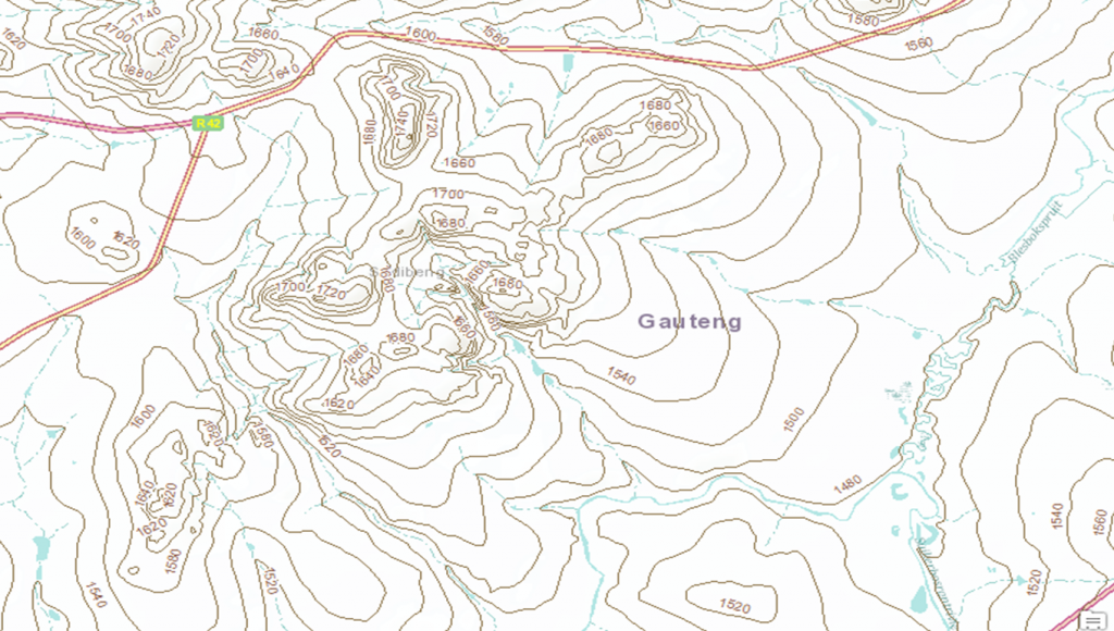
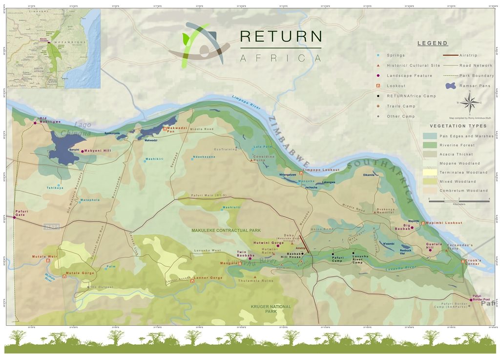
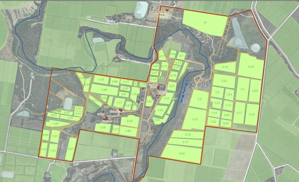
A Geographical Information System (GIS) is a computer-based tool used for the capturing, manipulating and visualising of spatial data. Many people think GIS is making pretty maps and we can certainly do that, but ultimately the strength of GIS is in using spatially relevant data to enable enhanced decision making and potential cost saving as a result of greater efficiency.
GIS can be used in assessments/feasibility studies and management and planning applications in the following industries:
- Environmental
- Agriculture
- Forestry
- Conservation & Protected Areas
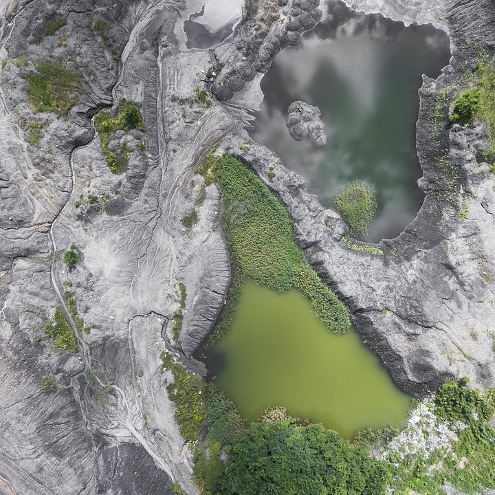
- Mining & Exploration
- Disaster Management
- Town Planning & Developments
- Tourism
GIS outputs/services include:
- Sourcing of data from available, current & historical databases, satellite, aerial photography & drone imagery
- Capturing, compiling and managing data
- Analysis/Modelling of data
- Present spatial data in maps and graphs
- Monitoring and change analysis
- GIS training & support

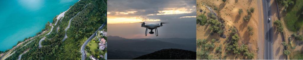
Drone/UAV Services
We have partnered with a drone company that is fully licensed and insured to add to our data sourcing offering.
We are able to provide current, high resolution aerial photography and remote sensing data in the form of:
- Aerial photography/orthomosaics
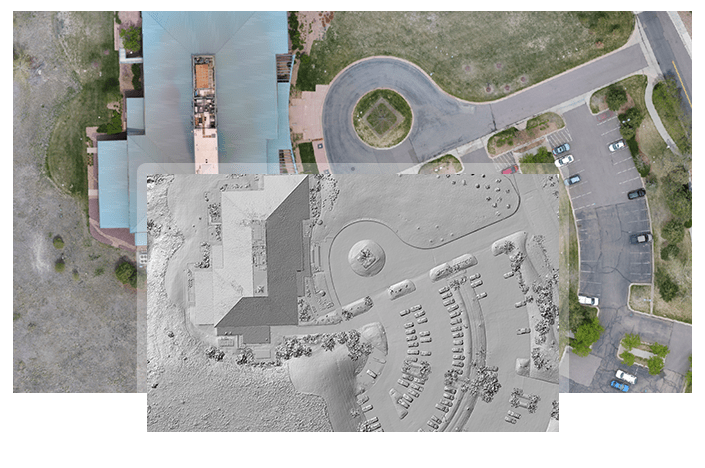
- Digital Elevation Models (DEM) (within 2cm accuracy)
- Digital Surface Models (DSM) (within 2cm accuracy)
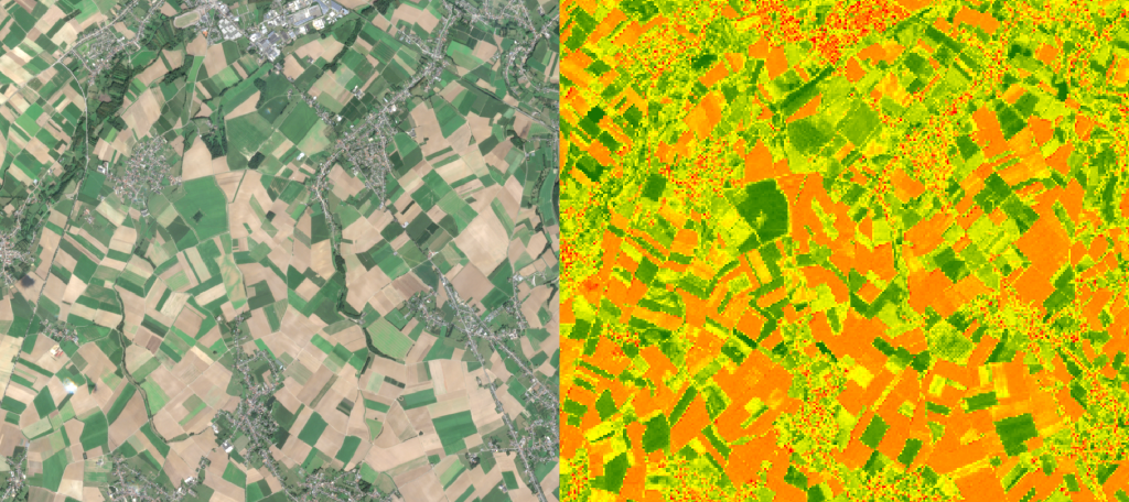
- NDVI/NIR (vegetation health)
- 3D Modelling/point clouds
- FLIR (heat sensing)
- Video
Why use us?
- Registered, licensed and insured UAVs
- Authorised to fly extended line of site (up to 1km from pilot)
- Access to a large fleet of drones, for multiple applications
- Can apply to fly within controlled airspace
- Access to multiple cameras with a range of applications
- Can fly country wide
- Access to multiple GIS databases to integrate with imagery for enhanced decision making and cost saving
- The added benefit of GIS and modelling software with the power of data interpretation and analysis
- With our environmental and GIS experience we understand the data outputs and will therefore collect more useful data
*For those that have drone imagery, we offer data processing & analysis of your data using specialised software.*